My Store
Beaujolais Wine Map
Beaujolais Wine Map
Couldn't load pickup availability
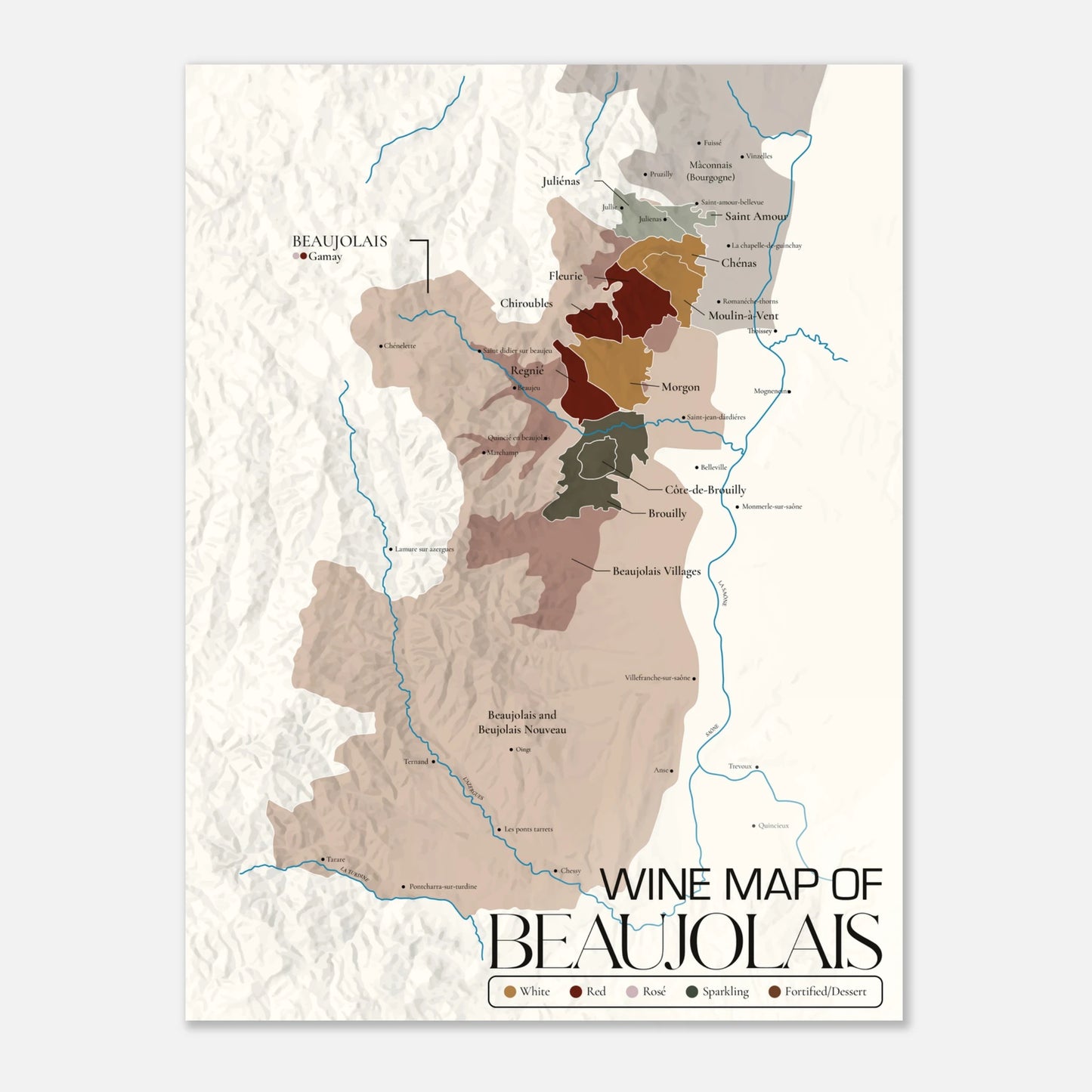
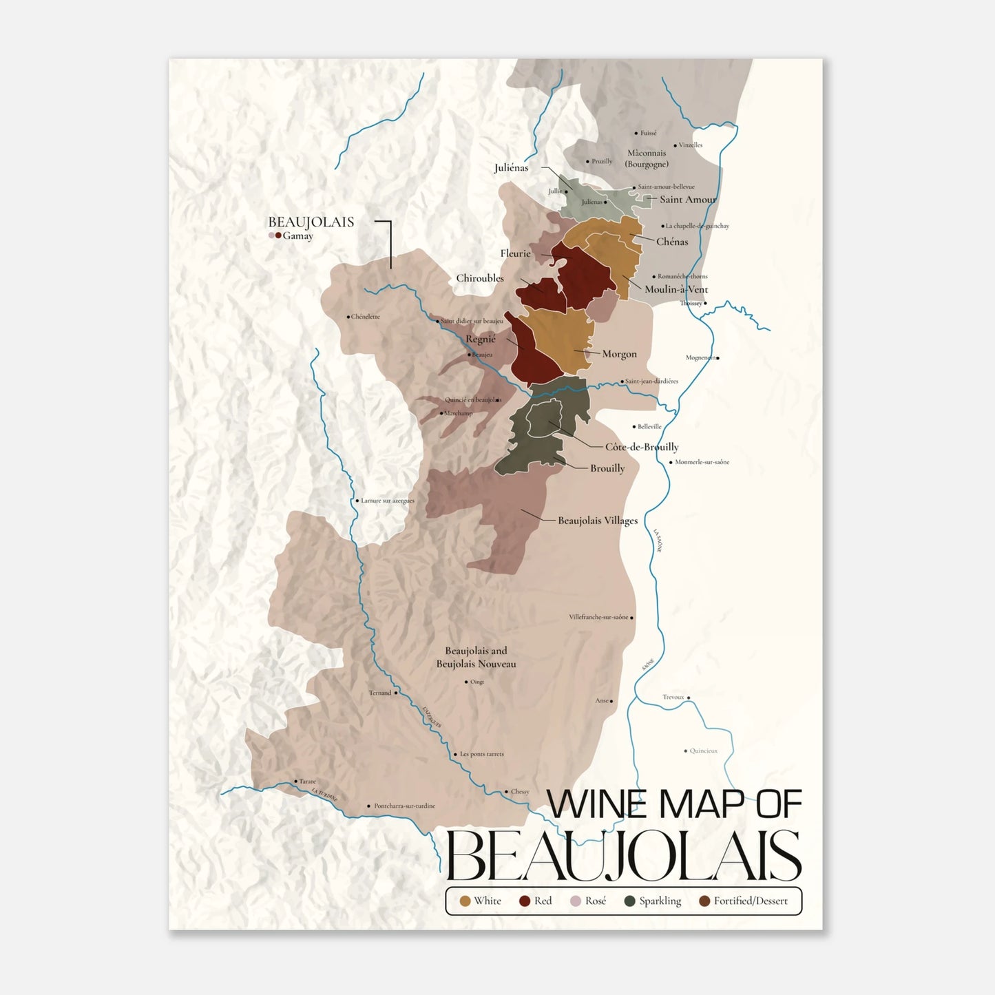
Educational Beaujolais Wine Map
Unlock the vibrant terroirs of Beaujolais with this meticulously designed educational wine map—an essential resource for wine students, sommeliers, educators, and enthusiasts alike.
Crafted with precision and clarity, this map illustrates all 10 Beaujolais crus, key villages, vineyard zones, and appellation boundaries, alongside major geographical features that influence the region’s wines. Clear color coding and detailed labeling make it easy to visualize the distinctions between areas such as Morgon, Fleurie, and Moulin-à-Vent, while supplemental notations highlight soil compositions, elevation ranges, and climate nuances that define Beaujolais’ signature expressions of Gamay.
Whether displayed as a study tool in a tasting room, used as a visual aid during WSET or sommelier training, or kept as a reference in your personal collection, this map transforms complex geography into an engaging, easy-to-understand visual journey.
Key Features:
-
Detailed appellation boundaries for all 12 Beaujolais AOCs
-
Color-coded crus with village names and notable landmarks
-
Terrain, rivers, and elevation for terroir context
-
Ideal for wine education, tastings, and certification prep
-
Printed on high-quality, durable material for long-lasting use
Bring the story of Beaujolais to life—one vineyard at a time.
Poster made on our lighter-weight, uncoated classic matte paper. The perfect option to stand the test of time:
- Paper Finishing: Matte, smooth, non-reflective surface.
- Paper Weight: 170 gsm (65 lb), thickness: 0.19 mm (7.5 mils), sturdy and durable.
- Sustainable Paper: FSC-certified or equivalent for sustainability.
- Available Sizes: 29 sizes in inches (US&CA) and cms (rest of the world).
Learn about paper types and their unique textures and finishes here.
No minimum orders, printed and shipped on demand.
Share